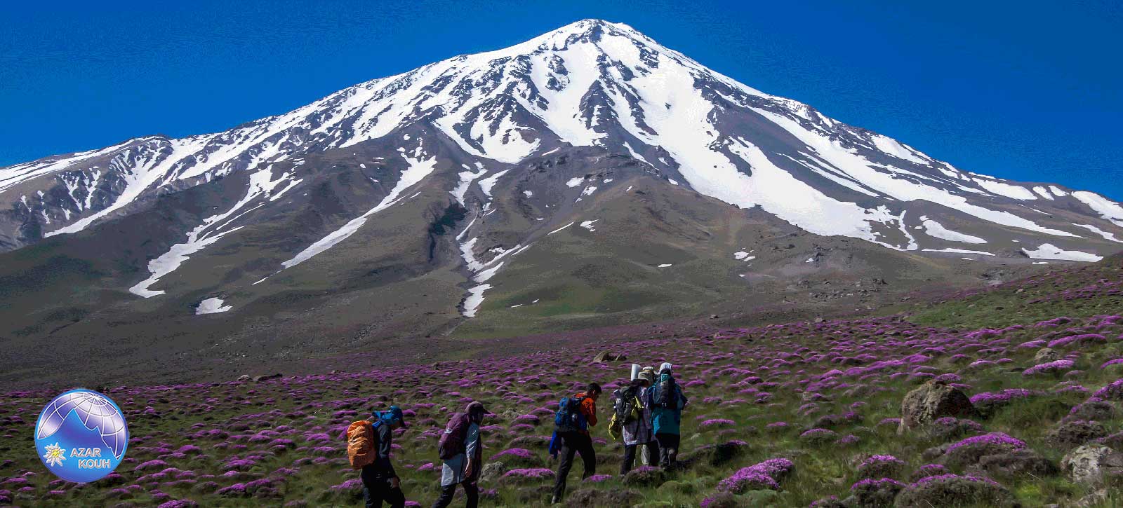
Mount Damavand a potentially active volcano 5600-m high, is a stratovolcano that is the highest peak in Iran and the highest volcano in Asia Damavand has a special place in Persian mythology and folklore. It is in the middle of the Alborz range, adjacent to Varārū, Sesang, Gol-e Zard, and Mīānrūd. It is near the southern coast of the Caspian Sea, in Amol County, Mazandaran Province, 66 kilometers (41 miles) northeast of the city of Tehran Mount Damavand is the 12th most prominent peak in the world and the second most prominent in Asia after Mount Everest. It is part of the Volcanic Seven Summits mountaineering challenge
Damavand is a significant mountain in Persian mythology. It is the symbol of Iranian resistance against despotism and foreign rule in Persian poetry and literature. In Zoroastrian texts and mythology, the three-headed dragon Aži Dahāka was chained within Mount Damavand, there to remain until the end of the world. In a later version of the same legend, the tyrant Zahhāk was also chained in a cave somewhere in Mount Damavand after being defeated by Kaveh and Fereydūn. Persian poet Ferdowsi depicts this event in his masterpiece, the Shahnameh
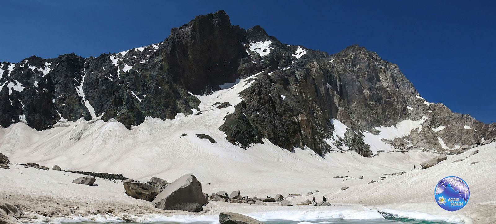
AlamKouh also Alam Kuh is a mountain in the Alborz mountain range in the north part of Iran, Mazandaran Province, forming a peak of Takht-e Suleyman Massif. It is located in the Kalardasht District of Mazandaran Province of Iran. With an elevation of 4,850 meters, it is the second-highest peak in Iran after Mount Damavand
The first recorded ascent of the peak was made from Hesarchal over the south face by the German brothers Bornmüller during their six-month botanical exploration of the Alborz in 1902 Douglas Busk, a British mountaineer, climbed AlamKouh via the east ridge in 1933 and again in 1934 from over the west ridge
The 800 m high, steep granite north face provides some of the most difficult and interesting mountaineering routes in the country, and the climbs rank alongside major climbing routes in the European Alps. In addition to local climbers, the north face attracts European climbing teams. The first known ascent from the north was by a German party (Gorter / Steinauer) in 1936 via the northwest ridge. Subsequently, French and Polish teams established other routes on the north face during the 1960s and 1970s, these being multi-day routes of high alpine standard. A British team followed with a successful ascent in 1978
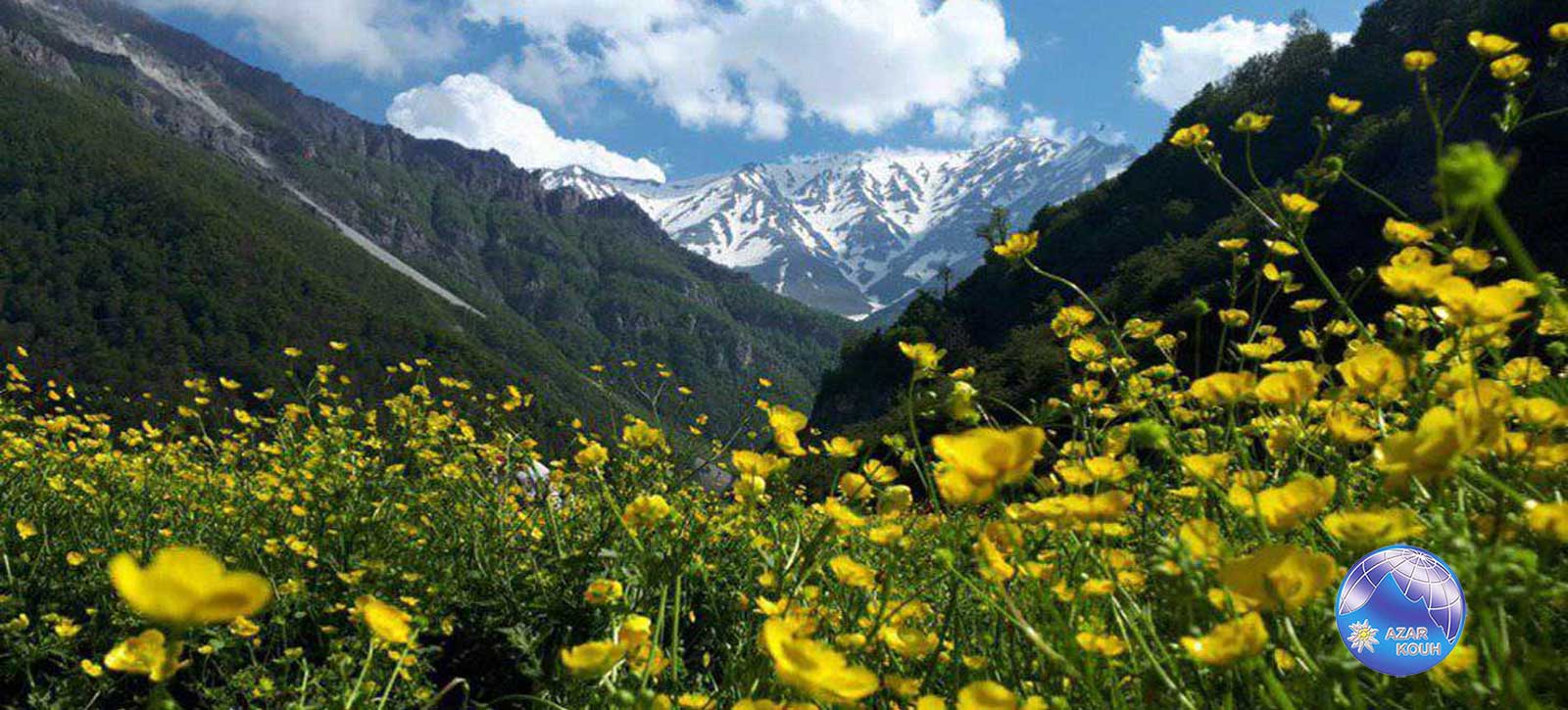
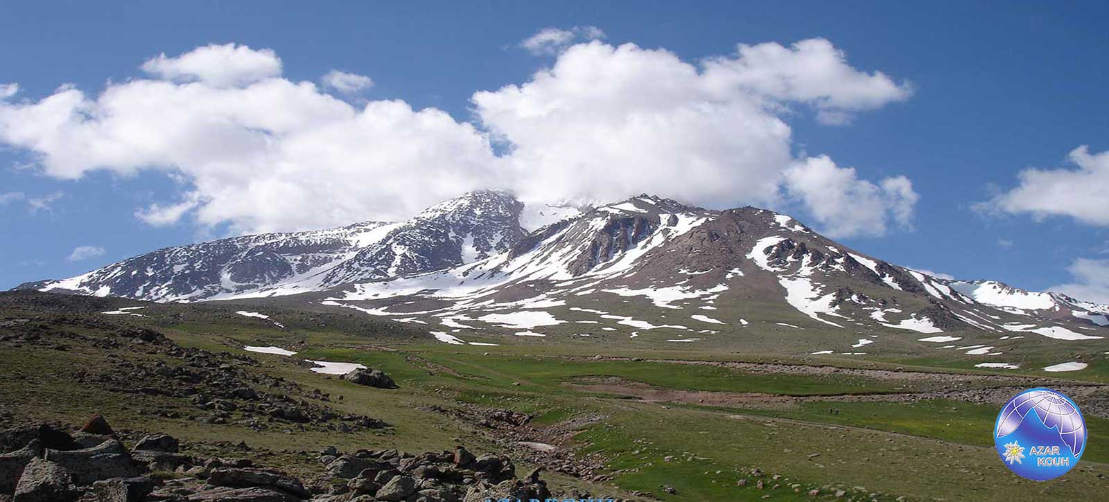
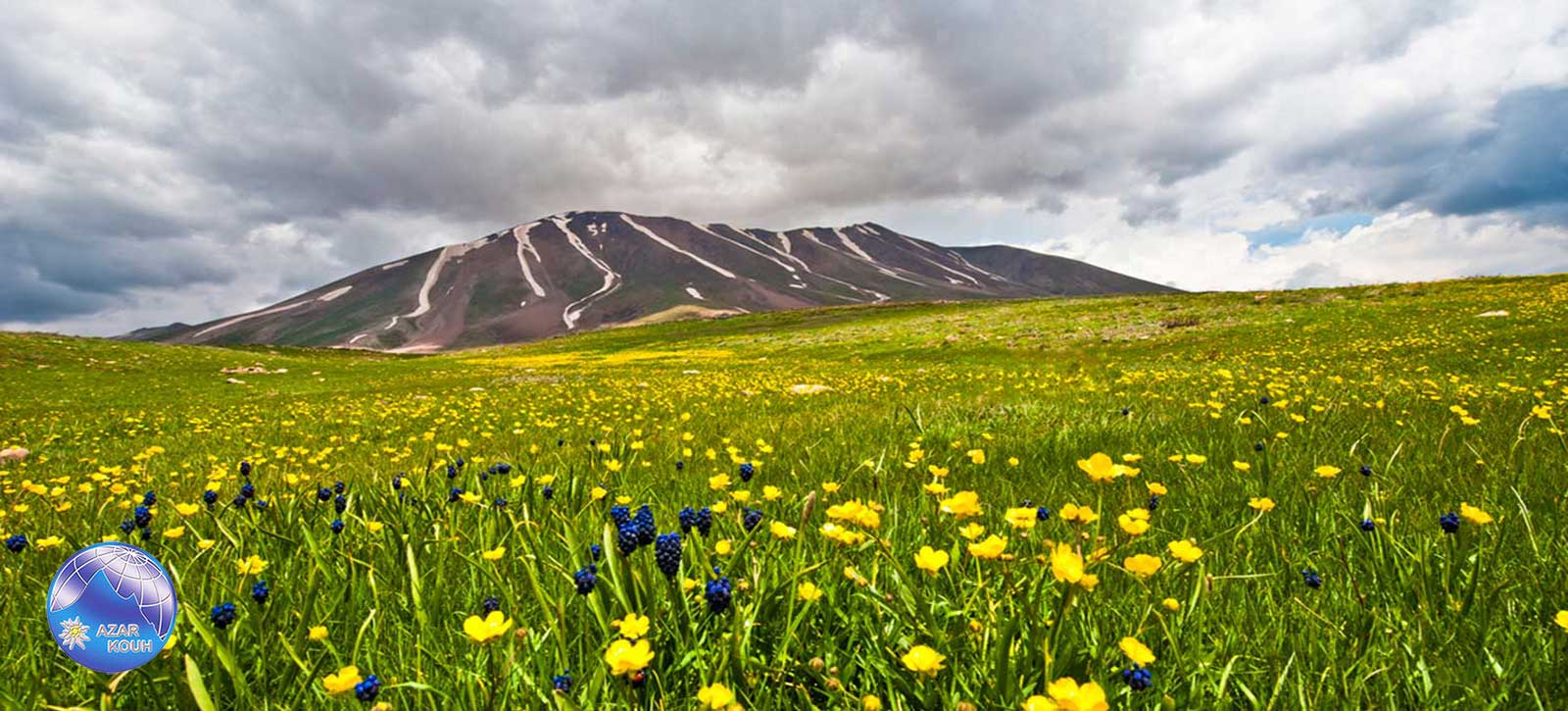
Sabalan locally named Savalan is an inactive stratovolcano in the Lesser Caucasus mountain range and Ardabil Province of northwestern Iran
at 4,811 meters (15,784 ft.) in elevation, it is the third-highest mountain in Iran. It has a permanent crater lake formed at its summit. On one of its slopes around 3,600 meters (11,800 ft) in elevation, there are large rock formations of eroded volcanic outcrops that resemble animals, birds, and insects
Located in the extreme northwest of Iran, Sabalan is the country’s third-highest peak after Damavand and AlamKouh. It is also slightly higher than Mont Blanc in the Alps
The mountain offers many attractions throughout the year. On the slopes of the hill, the mineral water from the springs attracts large numbers of tourists each year, many of whom have faith in the healing properties attributed to the springs. The nomadic people of the area live in small villages, with their round “Yurt” tents appealing to tourism. Sabalan has a ski resort (Alvares) and tourist areas like the Sarein Spa. The mountain is known for its beautiful vistas, including the Shirvan Gorge, where few climbers ever venture
Zard-Kuh (meaning “Yellow Mountain”, also spelled Zard Kuh, Zard Kuh or Zard Kuh-e Bakhtiari is a sub-range in the central Zagros Range, Iran
With an elevation of 4,221 meters, the Zard-Kuh is located in the Zagros Mountains in the Chaharmahal and Bakhtiari Province of Iran. The Karun and also Zayanderud rivers start in the Zagros mountains near the Zard-Kuh. There are small glaciers on the mountain owing to the relatively high precipitation, which are the only glaciers in the subtropics outside the Himalayas, the Andes, and the Trans-Mexican Volcanic Belt
Geologically, the Zard-Kuh is situated in the Sanandaj – Sirjan geologic and structural zone of Iran and is mainly made of Cretaceous limestone
The famous early documentary Grass captures on film the Bakhtiari tribe’s crossing of Zard-Kuh barefoot in the snow with 50,000 people and 500,000 animals
Oshtoran Kuh is a mountain that is located about 15 kilometers south of the city of Dorud in Lorestan Province in Iran. With an elevation of 4,050 meters, the Oshtoran Kuh is the highest mountain in Lorestan Province. Stretched in a northwest-southeast direction, the Oshtoran Kuh is situated in the Zagros Mountains and is among the high mountains of this range. The ِDez Dam starts in the Zagros mountains near the Oshtoran Kuh
Sahand is a massive, heavily eroded stratovolcano in East Azerbaijan Province, northwestern Iran. At 3,707 m (12,162 ft.), it is the highest mountain in the province of East Azarbaijan
It is one of the highest mountains in Iranian Azerbaijan, in addition to being an important dormant volcano in the country. The Sahand mountains are directly south of Tabriz, the highest peak of which is Kamal at an elevation of 3,707 m (12,162 ft). Approximately 17 peaks can be accounted for as being over 3,000 m (9,843 ft) in height. Due to the presence of a variety of flora and fauna, the Sahand mountains are known as the bride of mountains in Iran
The absolute dating of Sahand rocks indicates that this volcano has been sporadically active from 12 million years ago up to almost 0.14 million years ago. Sahand is made chiefly of dacite and associated felsic rocks